Over the years our understanding of heaven and earth has devolved. In recent centuries, we’ve descended into this nihilistic path of Heliocentrism. But maybe it should be called Heliosorcery since distorting one’s worldview can have deleterious psychological effects on the mind.
For literally thousands of years mankind has understood that the earth beneath his feet does not move; it was our foundation. Earth was not some spinning space ball hurling through the universe at a zillion miles an hour. When we think like this everything goes to sh!t due to the psychological chaos hurled upon us for believing in a Godless fantasy where we have no ontological footing and everything is just a product of time and chance.
Look at these maps. What do you see?
A Byzantine Greek world map according to Ptolemy’s first (conic) projection. From Codex Vaticanus Urbinas Graecus 82, Constantinople 1300 A.D.
The Ptolemy world map, including the countries of “Serica” and “Sinae” (Cattigara) at the extreme right beyond the island of “Taprobane” (Sri Lanka) and the “Aurea Chersonesus” (Malay Peninsula).
Do these maps look like they show the inside or outside of a curved surface?
1493 map of the world – Secunda etas mundi (Schedel, Hartmann, 1440-1514)
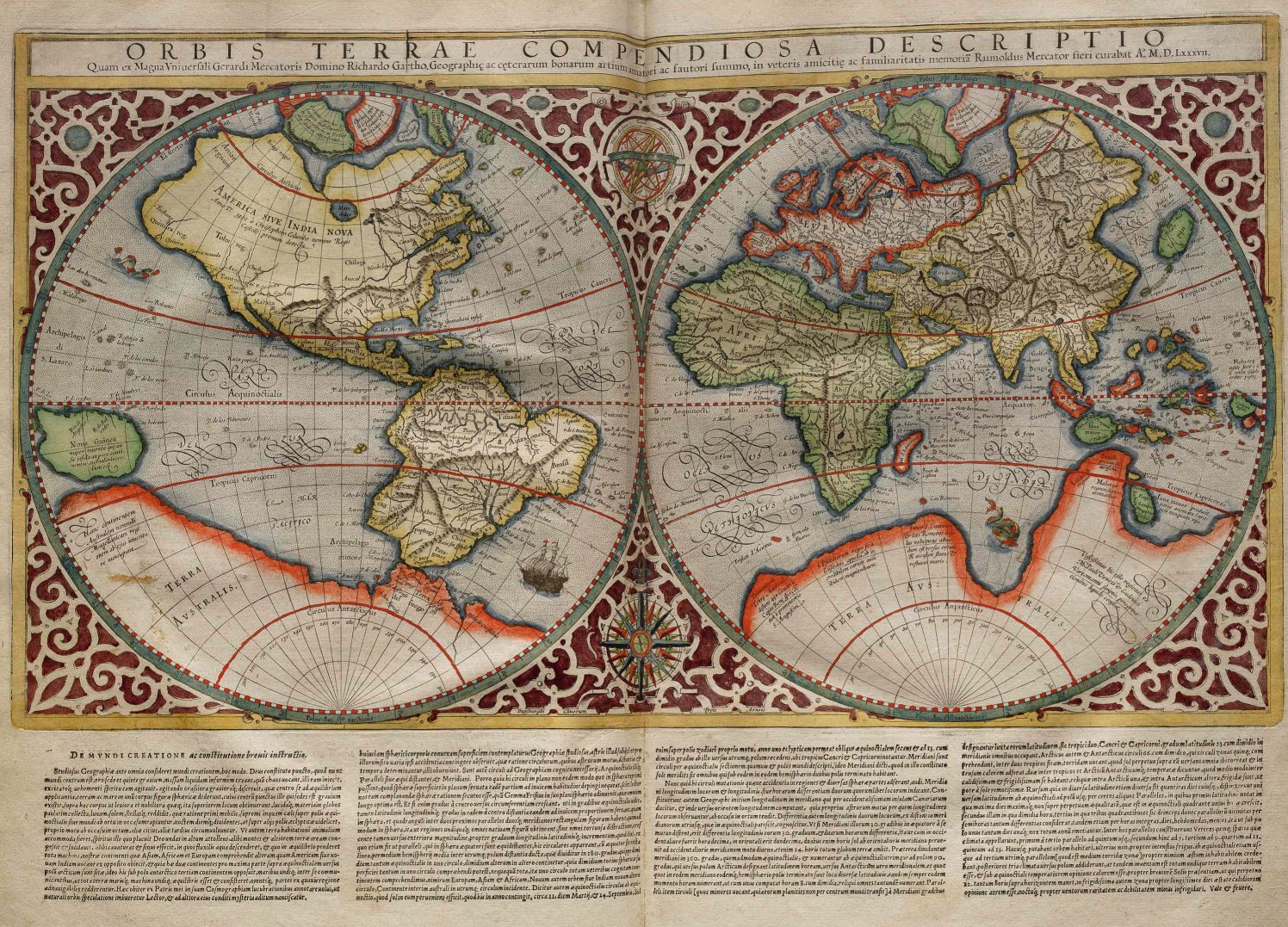
There are hundreds of different types of map projections, but one you’ll see the most of is the dual-hemisphere longitudinally-convergent projection, not a longitudinally-divergent projection that you’d expect on that of a convex surface.
Frederick De Wit’s 12-sheet World map of 1660
Rumold Mercator (Leuven, 1541 – Duisburg, 31 December 1599[1]) was a cartographer, son of Gerardus Mercator and brother of Arnold Mercator, both also cartographers.
He completed some at the time unfinished projects left after his father’s death and added new materials of his own research.
Wall Map of the World Mappe-Monde, Ou Carte Generale De La Terre, Divisee En Deux Hemispheres 1705
An attactive example of Mortier’s map of the World. Superbly decorated, elegantly engraved and full of cartographic intrigue, including an incomplete NW coast of America, incomplete Australia and New Zealand, misdirected tip of South America and remnants of the unknown Southern Continent. Pierre, or Pieter, Mortier (1661-1711) was a Dutch engraver, son of a French refugee.
1768 – Antique Map Of The World By Peter Meijer
Russian Cartographic Establishment of Alexey Ilyin 1884
1643 Melchior Tavernier, Nova Totius Terrarum Orbis Geographica Ac Hydrographica Tabula
Notice the north and south hemispheres of the celestial sphere placed in between the two world hemispheres, almost like it’s supposed to fit in the middle.
Same goes for this one…
Planiglobii Terrestris Cum Utroq Hemisphaerio Caelesti Generalis Exhibitio (1720)
Amsterdam City Hall Floor Map, De Grondt en Vloer vande Groote Burger Sael, 1661
It’s pretty obvious in this city hall floor plan from Amsterdam. The Celestial Sphere is placed in between the two concave longitudinally-convergent hemispheres.
Le Globe Terrestre Represente En Deux Plans-Hemispheres Dresse Sur la Projection de Mr. de la Hure de l’Academie Royale des Sciences (1775)
These fellers are holding up the world on their shoulders, exactly like Atlas did the Celestial Sphere. Notice again the spherical heavenly geometry placed in between the two world hemispheres.
Jan Huygen van Linschoten (1562-c.1611)
The signs of the zodiac are placed on the two hemispheres of the Celestial Sphere.
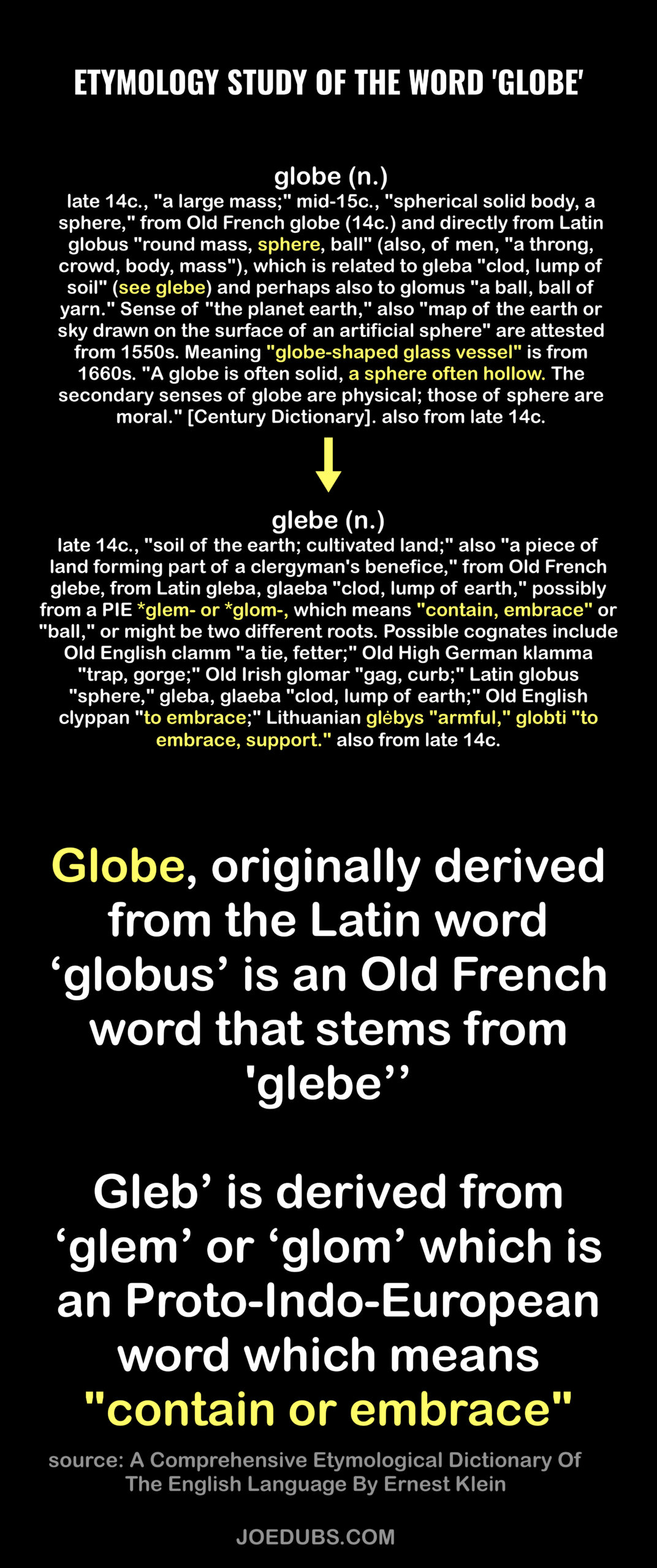
Another thing to notice is the lines of longitude. They are longitudinally convergent. The horizontal lines(longitude) are spaced closer together(converging) at the center than they are along left and right edges. We see this in nearly every old map. They are not maps of a spinning space ball; they are maps our cellular womblike Earth. Our maps are meant to wrap around the outside of the Celestial Sphere. Even the word “globe” itself comes from an Old French word that means ‘container’.
Here’s some more. This isn’t some odd phenomena found on a few maps here and there. Nearly all of these old maps show a concave surface, not a convex one, and there are hundreds of not thousands of them.
Globe is an Indo-European word that stems from ‘glem’ which means “to contain or embrace”. Atlas wasn’t holding the world on his shoulders. He represents Earth, and he is containing, embracing, enclosing the Celestial Sphere.
https://www.etymonline.com/word/globe
https://www.etymonline.com/word/glebe
The word ‘globe’ means ‘container’. Our early globes were just this, containers for the entire universe as we know it. We’ve always known that Earth is a sphere. It’s just that everything has been inverted. We must believe we live on the magical spinning space ball; anything else is crazy!
This is why Atlas held up the Celestial Sphere rather than the Earth. Atlas is synonymous for ‘map’ and it’s the reason he is shown embracing and enclosing the sky. Atlas is representative of the ‘globe’ in the truest sense of the word.
The first usage of the globe were among apothecaries, dating back to Caesar’s time.
“A show globe is a glass vessel of various shapes and sizes containing a colorful liquid. It has been a symbol of pharmacy from the 17th century England to the early 20th century in the United States. It marked the drugstore or apothecary in much the same way as the barber’s pole marked tonsorial establishments in some countries.” –wikipedia
https://waring.library.musc.edu/exhibits/ShowGlobes/Definition.php
Oddly enough the word “world” is also tied to the word ‘enclosure’. https://www.etymonline.com/search?q=world
WORDS DON’T MEAN WHAT THEY SEEM – JOEDUBS.COM
The truth is the ancients never believed in a flat earth, none of them. The Flat Earth, then and now, has always been a type of Plan-B for when people actually start digging into this stuff, questioning their reality and the lies we’ve been taught.
The ultimate goal has always been to eliminate God from the picture, starting small with geocentrism by placing the creation in the center rather than the Creator. Then when you have Earth as a convex ball pretty much anything goes. This is where we get our entire understanding of everything from evolution, the distances and sizes of planetary bodies, what the sun and moon are, red-shift, heliocentrism, age of Earth, the big bang, everything.
With the spinning space ball convex Earth, it was possible to eliminate God.
With a true understanding of what Heaven and Earth are, it’s impossible.
“The demonic (worldly) entities claim that this universe is without truth , without foundation, without God , but has arisen purely from sexual union , and pure lust is its only cause.”
– Bhagavad Gita, 16:8
^https://www.youtube.com/watch?v=HUYkhQ25A64&t=1s
Resources:
https://concavemaps.wordpress.com/
https://concaveearth.net/t/concave-earth-world-maps-in-plain-sight-historical-ancient-maps-concave/85
https://concaveunbound.wordpress.com/2018/03/26/concave-earth-maps-galore/
Discover more from JoeDubs
Subscribe to get the latest posts sent to your email.


Awesome research my friend!