In 1897, on a stretch of beach near Naples, Florida, a small group of Koreshan experimenters tried to measure the curve of the Earth without looking at the horizon, the stars, ships, or any of the usual arguments that turn every cosmological debate into a food fight.

Their instrument was called the Rectilineator.
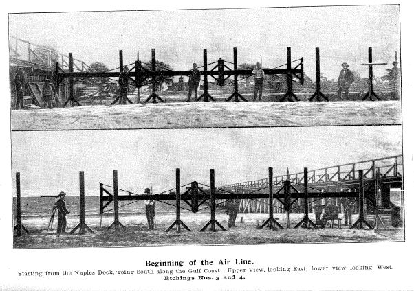
It was not subtle. It was a mechanical straight-line machine built from twelve-foot sections of mahogany, cross arms, brass fittings, steel tension rods, set screws, plumb lines, spirit levels, and a mercurial geodetic level. The Cellular Cosmogony describes the sections as double T-squares, each 12 feet long, with 4-foot braced cross-arms, inch mahogany seasoned for twelve years, brass facings, and adjustable platformed standards.[^1]
The idea was simple enough to be dangerous: establish a straight mechanical line over distance, compare it against a water-level datum, and see which way the Earth's surface bends.
If the conventional globe model is right, the surface should curve away from a true straight line. If the Koreshan model is right, the surface should rise toward it. From the apparatus, the line should appear to descend toward the water in a way consistent with living inside a sphere rather than on the outside of one.
That was the claim, anyway.
The Naples beach experiment
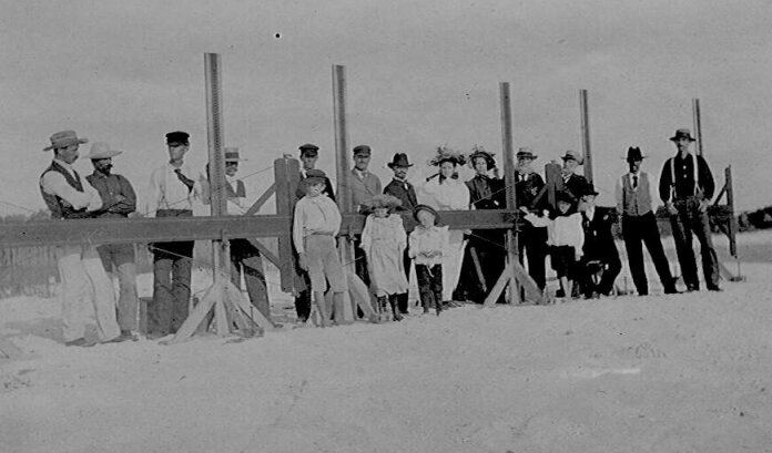
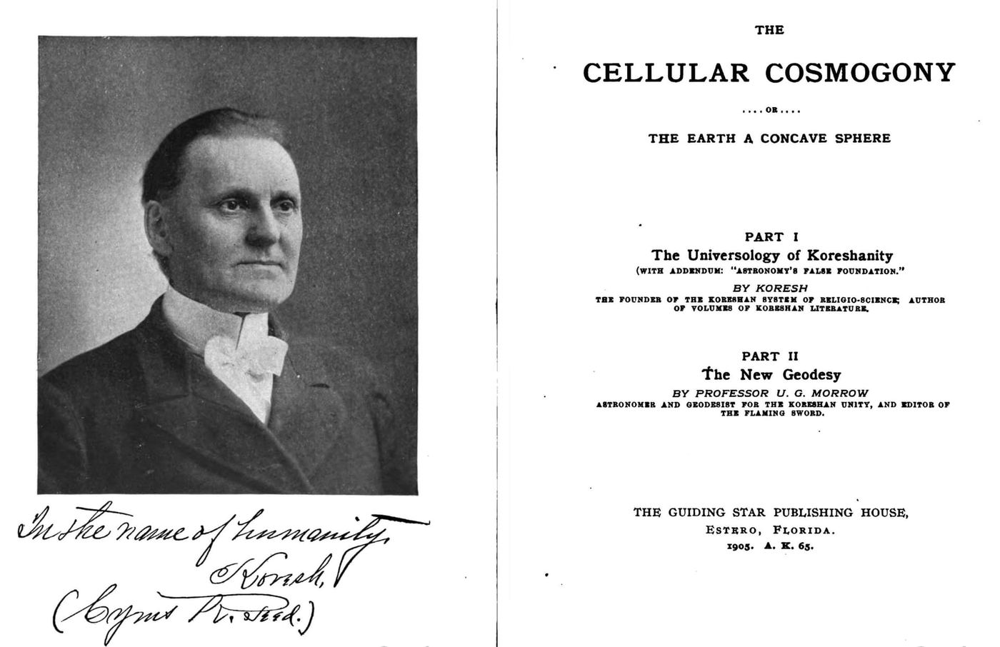
The experiment was associated with Ulysses G. Morrow, working in the orbit of Cyrus R. Teed, the founder of Koreshanity. Teed and Morrow later published the system in The Cellular Cosmogony, where the Rectilineator became the flagship mechanical demonstration for the "new geodesy." In the Google Books scan cached for this article, the Rectilineator section begins with "The Invention of the Rectilineator" on book page 95 and runs through the apparatus, Naples survey, tide-register method, witness list, measurements, and conclusions across roughly book pages 95–130.[^2]
The datum method matters. The Koreshan account says the experimenters used a caisson with perforations and a tide staff to quiet wave motion and establish mean tide level, then transferred a 128-inch reference altitude to tide-staff stations along the beach.[^3]
That is the part skeptics should attack if they want to beat the experiment properly: not the vibes, the datum.
The reported numbers are what make the story hard to dismiss as merely colorful. According to the surviving Koreshan source trail, the Rectilineator measured approximately:
- 8.02 inches of descent at 1 mile
- 30.62 inches at 2 miles
- 48.25 inches at 2⅜ miles
These figures appear in the main measurement table in The Cellular Cosmogony, with a convex comparison table repeating the same key values a few pages later.[^4] The book later summarizes the claim as the water surface curving concavely "about 8 inches to the mile, or 128 inches … in about 4 miles."[^5]
Those numbers are not random tavern-math. They sit in the neighborhood of an Earth-radius-scale curve. One skeptical summary even grants the striking point: the reported results were consistent with an Earth circumference of roughly 25,000 miles.
The machine allegedly produced a coherent curve, and a coherent curve demands a mechanical explanation. Either the Rectilineator was tracking the curve its operators claimed, or the apparatus was introducing a hidden bias precise enough to imitate one.
Gordon's Pass split the experiment in two
The first 2½ miles were mechanically advanced, section by section, along the beach. Then the line reached Gordon's Pass. The lower cross-arms were already close to the ground, and the pass, sandbar, and excavation stopped the apparatus from moving forward.[^8]
The extension across the pass was visual. The operators set a telescope at record stake No. 19, trained it on a fixed steel strip on the apparatus, and followed the projected line south toward the Gulf. A sailboat was sent out along the claimed direction. The report says the cross-hair met the bottom of the boat about a mile and a quarter south of the station, putting the claimed point where the line entered the water about four miles from its beginning.[^8]
That distinction matters because the two stages did different jobs. The beach line was built by repeated mechanical adjustment; the longer continuation depended on a telescope, a reference strip, the water, and a boat. Samuel Blodgett later pressed exactly this point: if the visual line curved as the Koreshans said it did, how could the telescope extension be treated as a straight continuation of the surveyed line?[^9]
The record does not hide the change in method. It prints it. The Florida survey, its visual extension, and the later replies need to stay together if the reader is to see what was measured on land and what was carried over the pass by sight.
The machine that tried to neutralize itself
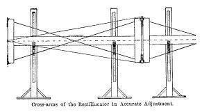
One of the more interesting details in the Rectilineator account is that the operators claimed to use reversal to cancel construction errors. The book says four weeks were spent testing the right angles, with each section "reversed, end for end, and turned over fifty times" during shop/platform testing.[^6]
It then says the actual survey used Castle's system of "turning over each section at its every alternate adjustment," with the check books showing the method was applied throughout the line.[^7]
The source trail says:
"The method employed to insure further accuracy was by making the apparatus neutralize its own inaccuracies by reversal or turning-over of each section at every alternate adjustment."
That is the kind of detail worth preserving. It shows that the claim was not simply "we built a long ruler and trusted it because we liked it." The apparatus was supposed to be self-checking. Sections were moved forward in sequence, reversed, leveled, and checked against records.
Another account says:
"Every item of adjustment, test, observation, and measurement was checked in the check record book, and described in detail in the daily record book, to which are appended the signatures of all operators and witnesses."
That raises the standard of response. If someone wants to answer the Rectilineator, the serious route is not ridicule. The serious route is mechanical: show where a systematic bias entered the procedure.
That is exactly where Donald Simanek's critique becomes useful.
Simanek's skeptical treatment does not need the results to be gibberish. The more precise objection is that the apparatus and method could have produced a systematic false curve — through tiny alignment errors, sag, leveling procedure, thermal effects, support conditions, or the cumulative behavior of the sections as they were advanced down the beach.
That is a much better argument than pretending the experiment never existed. It also gives us the real question:
Did the Rectilineator measure the Earth, or did it measure its own hidden bias?
That question is worth the article by itself.
The Tamarack Mine
Where the Rectilineator measured the curve with a straight line, the Tamarack story turned on verticals. Plumb lines, not mahogany beams. Later retellings gave them the same inward conclusion.
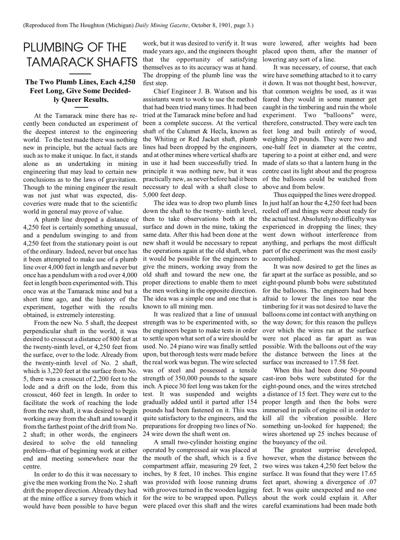
Long plumb lines dropped thousands of feet into Michigan mine shafts supposedly ended farther apart at the bottom than at the top. The later version placed two shafts roughly 4,250 feet deep and 4,250 feet apart, with the lines 8.22 inches farther apart at the bottom. In a convex world, plumb lines should converge. Divergence suggests the opposite.
The story traces back to F. W. McNair's 1902 paper, "Divergence of Long Plumb-Lines at the Tamarack Mine," in Science. The paper is real. The mine is real. But McNair's table shows mixed results. Some convergence, some divergence. One Shaft No. 5 measurement: 0.141 ft of divergence. Another: 0.018 ft, which McNair chalked up to convection current.
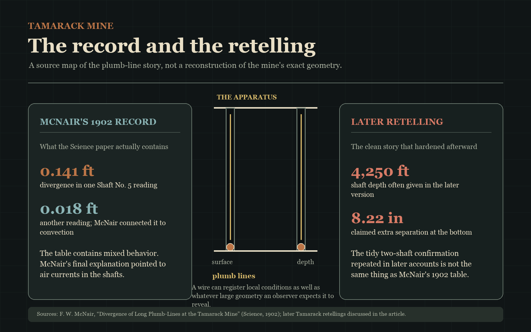
McNair's conclusion was not what Concave Earth retellings would have you believe:
"The data shown in the table seemed to afford ample experimental proof that neither gravitation nor magnetism could account for the divergence originally observed. Further, it seemed that the results pointed clearly to the currents of air in the shafts as the disturbing cause."
Air currents. Not inverted gravity. The paper that launched the Tamarack legend ended by pointing at the ventilation system.
The more dramatic version, two shafts with clean divergence of 8.22 inches, hardened into the story later, especially in Ray Palmer-style retellings. Simanek's note is worth keeping in your pocket:
"At the present time I have been unable to locate any solid evidence that the proposed experiment using two mine shafts 3,200 feet apart was ever performed."
Tamarack happened. McNair measured something. But the clean two-shaft confirmation everyone repeats is not in McNair's paper. It came later, in the retellings.
The vertical test that stayed on paper
The Koreshans wanted a cleaner version of the same question. In "Koreshan Astronomy (No. 6)," the writer proposed hanging paired plumb lines from the Eiffel Tower, the Leaning Tower of Pisa, or deep mine shafts. At one twenty-fourth of a mile, the predicted difference was only .013 of an inch. The proposed apparatus was trying to catch a nearly invisible change in the direction of verticals.[^10]
No completed Eiffel Tower or Pisa test appears in the periodical record. The Naples line remained the experiment the article treated as already finished. The tower and mine-shaft examples are useful precisely because they show where the theory wanted to go next: not to another horizon photograph, but to a direct measurement of perpendiculars.
Two older instruments in the same argument
Airy's Harton Pit. In 1854, George Biddell Airy ran pendulums at the surface and 1,260 feet below it in Harton Colliery near South Shields. The purpose was to compare gravity at two levels and calculate the Earth's density. Tamarack came nearly half a century later with wires instead of pendulums, but the practical difficulty was already familiar: mine air, rock, temperature, and the apparatus itself can become part of the result.[^11]
Maskelyne at Schiehallion. In 1774, Nevil Maskelyne observed stars from opposite sides of the Scottish mountain to detect the mountain's pull on a plumb line. His 1775 report treated the vertical as something that could be shifted by local mass. That is the older experimental background behind every later argument over whether a hanging wire records the world's form, the ground under it, or both.[^12]
Sources
- Cyrus R. Teed and Ulysses G. Morrow, The Cellular Cosmogony / The New Geodesy.
- F. W. McNair, "Divergence of Long Plumb-Lines at the Tamarack Mine," Science, Vol. XV, No. 390, June 20, 1902, pp. 994–996.
- Donald E. Simanek, "Naples Geodetic Survey" / Rectilineator critique.
- Donald E. Simanek, "The Tamarack Mines Mystery."
- "Concavity Demonstrated! The Air Line Extends into the Water Four Miles!" The Flaming Sword, source scans pp. 19–20.
- "Koreshan Astronomy (No. 6): Usual Suppositions Concerning Perpendiculars," The Flaming Sword, source scans pp. 5–6.
- George Biddell Airy, Lecture on the Pendulum-Experiments at Harton Pit, delivered October 24, 1854.
- Nevil Maskelyne, "An Account of Observations Made on the Mountain Schehallien for Finding Its Attraction," Philosophical Transactions, Vol. 65 (1775), pp. 500–542.
[^1]: The Cellular Cosmogony, book pp. 95–96 / PDF pp. 116–117. [^2]: The Cellular Cosmogony, Rectilineator section, book pp. 95–130 / PDF pp. 116–151. [^3]: The Cellular Cosmogony, book pp. 106–109 / PDF pp. 127–130. [^4]: Main measurement table: The Cellular Cosmogony, book p. 123 / PDF p. 144. Convex comparison table: book p. 127 / PDF p. 148. [^5]: The Cellular Cosmogony, book p. 130 / PDF p. 151. [^6]: The Cellular Cosmogony, book p. 102 / PDF p. 123. [^7]: The Cellular Cosmogony, book pp. 102–103 / PDF pp. 123–124. [^8]: "Concavity Demonstrated! The Air Line Extends into the Water Four Miles!" The Flaming Sword, source scans pp. 19–20. [^9]: Samuel Blodgett, "Blodgett's Visual-Line Objection Revisited," The Flaming Sword, source scans pp. 11–12. [^10]: "Koreshan Astronomy (No. 6): Usual Suppositions Concerning Perpendiculars," The Flaming Sword, source scans pp. 5–6. [^11]: George Biddell Airy, Lecture on the Pendulum-Experiments at Harton Pit, delivered October 24, 1854. [^12]: Nevil Maskelyne, "An Account of Observations Made on the Mountain Schehallien for Finding Its Attraction," Philosophical Transactions, Vol. 65 (1775), pp. 500–542.